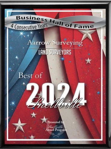

Awards and Affiliations


We would like to take a moment to introduce our company!
Prompt and Reliable
Registered Land Surveyors
Prompt and Reliable
Aarrow Surveying is Experienced
- AARROW SURVEYING clients have included City of Forest Park, City of Eastpoint, City of Hapeville, Fulton County, Rosser International, Inc., Mote Engineering, Inc, Piedmont Design Group, True Vine Engineering, Tibbitts Land Surveying, Hartrampf Engineering, Media One and Comcast Cable, Project Earth, Beiser Properties, Moorhead Properties, Peachtree Gardens Development, Brookhaven Homes, and many more.
- AARROW SURVEYING Projects have included writing legal descriptions, computing surveys, drafting, boundary surveys, as-built surveys, topographic surveys, tree surveys, construction surveys, courthouse research, application of title commitments, volumes calculations, working with local municipal governments and government departments for permitting approvals, writing proposals and completing bid takeoffs, providing professional consulting and witness services, account billing and collections, running and scheduling crews, payroll services and general business management.
- AARROW SURVEYING has established a relationship and reputation for providing our services.
Introduction
Registered Land Surveyors
Prompt and Reliable
Who is Aarrow Surveying
- AARROW SURVEYING would like to offer our surveying services as needed.
- AARROW SURVEYING has been developed to offer a wide range of surveying services. We have surveyed in Georgia and the southeast U.S. region for the more than thirty years. The application of current technologies in both field and office are used. These procedures shall enable quick and accurate communications and productivity while minimizing errors.
Lannes Kurt Burkhalter
Owner
- Professional License:
- Georgia Registered Land Surveyor - #2581
- Education:
- Macon Junior College– 1976-1977
- Control Data Institute - 1980
- Dekalb Community College– 1980-1981
- Southern Technical College 1982
- ICS Surveying and Mapping Program - 1990
- Work Experience:
- 49 years experience in Land Surveying and Civil Support
- - 1976 – 1978 Conine Coastal Surveying and Land Planning
- - 1979 - 1981 Hartrampf/Powell Consulting Engineers
- - 1981 – 1995 Hill/Fister Engineers
- - 1996 Advance Survey, Inc.
- - 1997 – Current owner of AARROW SURVEYING
- Experience:
- - Boundary Surveys
- - Topographic Surveys
- - ALTA Surveys
- - Tree Surveys
- - Construction Surveying
- - Control Surveys
- - Route Surveys
- - Engineering Services
- - Residential and Commercial
- Projects:
- - Boundary and Topographic Survey of Kings Bay Naval Station in St. Mary’s Ga.,
- - Construction layout for F.L.E.T.C. base Brunswick, Ga.
- - Topographic Surveying for steam lines at Ft. Stewart
- - Control survey for Ford Plantation in Richmond Hill
- - Field and office design of Fulton County Outfall Systems
- - Construction and Building Services for DELTA Facilities at Hartsfield/Jackson International Airport
- - Construction Layout for the Laredo Marta Bus Facilities in Decatur, Ga
- - Survey of and design layout of Ravinia and Hyatt project in Dunwoody, Ga
- - Bridge layout for MARTA CN443 Project
- - Heavy duty paving survey services for airport work on taxiways, runways and refueling stations at McDill AFB Tampa, Fl., Jacksonville International Jacksonville, Fl, Hartsfield International Atlanta, Ga., Cherry Point MCAS Havelock, NC.,
- - Apartment layout for numerous Cardinal Industries sites all over Ga
- - Field and office surveys of 24,000 linear ft of sidewalk surveys for City of Forest Park
- - School layout projects for Forsyth and Walton County
- - Numerous Subdivision projects
- These projects have included field and office surveying services, consulting, project coordination with clients and municipal governments, permitting, business operations and general management
Registered Land Surveyors
Registered Land Surveyors
Registered Land Surveyors
You Should Know
- AARROW SURVEYING has a strong background providing civil support both in the field and office. With decades of experience in land surveying consulting, construction staking, plan reviews, inspection and application of plans, computations, initial takeoffs and bid documents.
- AARROW SURVEYING is registered with the Georgia State Composite Board and may provide service as a professional consultant these services can be provided on a lump sum basis, not to exceed basis, hourly or use our itemized fee schedule. We have experience providing mortgage/loan surveys, exemption plats, recombination plats, as-built drawings, estate tracts, right-of-way surveys, construction staking, topographic surveys, tree surveys, subdivisions, control surveys and ALTA/NSPS Land Title Surveys.
Reviews and References
Residential and Commercial Survey Samples
Compilation of Rural Residential Tracts
AARROW SURVEYING Professional Land Surveying Services

Land Title Surveys
Our land title surveys provide a comprehensive analysis of your property, including boundary lines, easements, encroachments, and other important information. This is essential for real estate transactions and resolving boundary disputes.
ALTA/NSPS Surveys
Our ALTA/NSPS surveys provide detailed information about your property, including boundary lines, improvements, and other important features. This is essential for commercial real estate transactions and can help you make informed decisions about your property.
Boundary Surveys
Our boundary surveys use state-of-the-art technology to accurately determine the boundaries of your property. We provide detailed reports that can be used for legal purposes and to resolve boundary disputes.
Topographic Surveys
Our topographic surveys provide detailed information about the contours and features of your property. This is essential for construction, engineering, and land development projects.
GNSS Applications
If needed or desired we can include both Static or RTK GNSS for data source and compliance with government requirements to apply for permitting.
Expert Witness Testimony
Our experienced surveyors can provide expert witness testimony in legal proceedings related to land surveying. We have extensive knowledge of the industry and can provide valuable insights and analysis to support your case.
Historic and Old Maps of The Southeast
Enjoy these pictures of Old Surveyors and their Crew Parties
For Your Information

EARLY SURVEYING AND SURVEYORS
Every since people have wanted to possess land, the need for surveying became necessary. This practice, art and industry is as old as the Bible and has become more dependent with time.
Cavemen protected their caves with clubs. Boundary questions or disputes have been relevant in religion, politics, taxes and personal worth's. It is of historical significance that over 5000 years ago, the boundaries of northern Mesopotamia, now Iran, had a map of the dynasty of Sargon of Akkad marked on clay tablets. The ancient Egyptians developed precise methods of measurement to build the Great Pyramids. The Nile river had to be surveyed constantly because of its annual flooding.
The Babylonians used boundary stones. The stones were carved with the land description and even the name of the surveyor upon them. These stones also had warnings and curses upon them if anyone was to infringe on the land or move the stones. When the first five books of the Old Testament were written, they made reference to land survey's. The Pentateuch, as these first five books were formally known, combines four major documents into a single literary unit about 400 B.C.
AS FOLLOWS:
And as for the western border, ye shall even have the great sea for a border; this shall be your west border. Numbers 34: 6
And the border shall go down to Jordon, and the goings out of it shall be at the salt sea: this shall be your land with the coasts thereof round about. Numbers 34: 12
Then said I, Whither goest thou? And he said unto me. To measure Jerusalem, to see what is the bresdth thereof, and what is the length thereof Zechariah 2: 2
And the city lieth foursquare, and the length is as large as the breadth: and he measured the city with the reed, twelve thousand furlongs. The length and the breadth and the height of it are equal. Revelation 21: 16
And he measured the wall thereof, an hundred and forty and four cubits, according to the measure of a man, that is, of the angel. Revelation 21: 17
These measurements used in biblical times were simple and not very precise, but they were the standards to be used. Thus the areas described did have a measurable limit. There are many more of these biblical references to surveying or surveying measurements.
The Romans used a device called the groma which had four arms set at 90 degrees. The Greeks believed in their mathematician Pythagoras. He believed the earth might be spherical instead of flat. Eratosthenes used units called stadia. In the Middle Ages the church used and prepared maps showing Jerusalem as the center of the world.
William the Conqueror ordered a survey of the lands of England so that he could more accurately assess the sums he should receive from the lords of the manors. The results of this survey were called the "Doomsday Book". It was a cadastral survey of the land with names of the owners and the extent, nature, and value of their holdings.
Estimate Request Below
Survey Estimates are based on our Standard Fee Schedule a copy of which can or will be provided upon acceptance of services being provided
Get a survey estimate here!
Contact us and make a request below.
Any information provided when requesting a quote is Private and Confidential and will not be shared with any third Parties.
Land Surveying Service Estimates Request
Requesting an estimate from AARROW SURVEYING is simple.
Please Provide as much of the available information below by submitting a quote request.
-----** OR **-----
You may also leave a detailed message at 770-982-9900. AARROW SURVEYING will then do basic research to complete your request and contact you. If additional information is needed we will contact you.
Based on your needs we may be able to reduce the scope of services, minimize fees and reduce the impact to your budget. We may be able to combine services that have overlapping procedures and give large discounts. This can easily save you BIG $$$$.
Contact Us
Send us a message, or call us for a quote. Use our contact form to tell us more about your project, and we will connect you with the services to fit your needs.
AARROW SURVEYING
Hours
Monday - Friday: 8am - 5pm
Saturday - Sunday: Closed